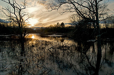
The Taunton River flows freely – without dams or other impoundments – from its formation at the confluence of the Matfield and Town Rivers in Bridgewater to the point forty miles downstream where it empties into Mount Hope Bay. The National Wild and Scenic Rivers Act of 1968 established a system to identify free-flowing rivers across the United States that possess “outstandingly remarkable values.” The values include scenic, recreational, geologic, fish and wildlife, historic, cultural or other similar values.
 The Act stipulates that these rivers “shall be preserved in free-flowing condition, and that they and their immediate environments shall be protected for the benefit and enjoyment of present and future generations.” The Act also prohibits the federal government from giving grants or loans or issuing permits or licenses for water resources projects (such as dams) that would have a “direct and adverse effect” on the values which earned the river its Wild and Scenic designation.
In 1988 a coalition of local citizens worked with the Southeastern Regional Planning and Economic Development District (SRPEDD) to develop a Taunton River Conservation and Management Plan. The goal of this plan was to preserve the natural resources in a 14.5 mile portion of the Upper Taunton River (from the confluence of the Town and Matfield Rivers to the Weir Village in Taunton) and to seek “Wild and Scenic River” status for this portion of the river. This group of citizens eventually formed an organization to continue this effort — the Taunton River Watershed Alliance.
In 2002, thanks to t he efforts of Representative Joseph Moakley and Senators Edward Kennedy and John Kerry, the U.S. Congress passed authorized funding to undertake a “Taunton River Wild and Scenic Study.” At the request of Representatives Barney Frank, Jim McGovern and Steven Lynch, the study area was extended to include the Lower Taunton River (from the Taunton-Raynham line to Mount Hope Bay).
To achieve the Wild and Scenic Designation for the Taunton River from the U.S. Congress, a Taunton River Stewardship Plan was developed by the Taunton River Wild and Scenic Study Committee. The Committee included a representative from each of the ten cities and towns that directly abut the mainstem of the river, as well as representatives from environmental groups and other organizations (click here for the plan and a list of committee members). This plan, completed in 2005, identified objectives to protect six “outstanding resource values” of the Taunton River including:
- agriculture;
- ecology and biodiversity;
- estuary;
- fisheries;
- history and archeology;
- recreation.
In March of 2009, as a result of these efforts and the invaluable assistance of SRPEDD, the National Park Service and our Congressional delegation, the U. S. Congress and President Obama added the Taunton River to the National Wild and Scenic Rivers System. The Taunton River Stewardship Council was established to implement the 2005 Stewardship Plan. TRWA is a member of the Council.