Click on image to enlarge
Geologic evidence indicates that 10,000 years ago the landscape of southeastern Massachusetts was covered by ice flows. The retreating glaciers created a large glacial lake that eventually drained to become the Taunton River and its tributaries. This river system ran though a landscape of glacial deposition that included outwash plains, wetlands and kettle ponds.
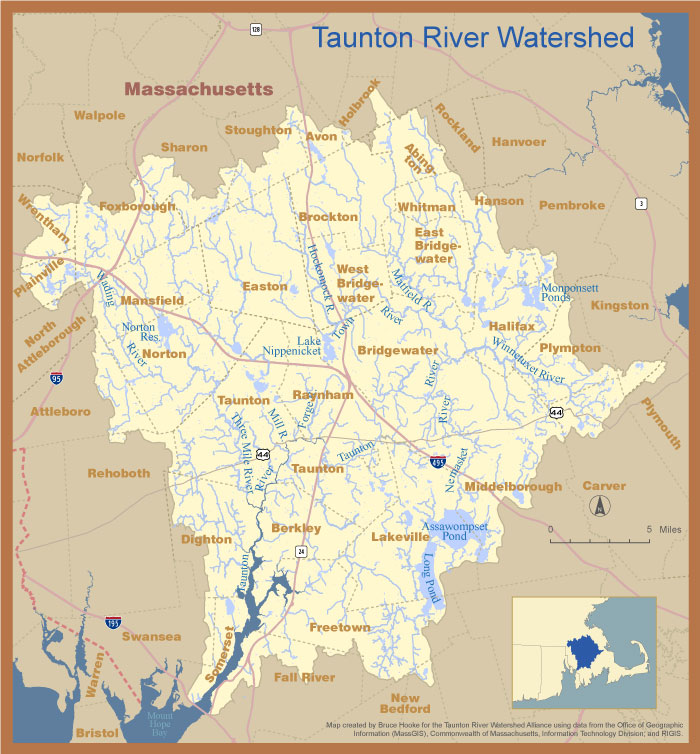
The land area that drains into a river is known as its “watershed.” The watershed of the Taunton River and all of its tributaries covers 562 square miles.
The Taunton River begins at the confluence of the Matfield and Town Rivers in Bridgewater and runs over forty miles to Mount Hope Bay. It is considered “tidal” (with saltwater intrusion) for the last eighteen miles and is characterized by a gentle gradient, dropping only twenty feet in elevation over its forty-mile course. With forty miles of free-flowing water, the Taunton is the longest undammed coastal river in New England.
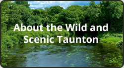 The National Wild and Scenic Rivers Act of 1968 established a system to identify free-flowing rivers across the United States that possess “outstandingly remarkable values,” and to protect them “for the benefit and enjoyment of present and future generations.” In 2009 the Taunton River was designated a Wild and Scenic River by the National Park Service, the U.S. Congress and President Obama. The Wild and Scenic Rivers System currently protects 12,709 miles of 208 rivers.
The Taunton River’s outstanding resource values include:
- Agriculture
- Ecology and biodiversity
- Estuary
- Fisheries
- History and archeology
- Recreation.
A “Taunton River Stewardship Plan” was completed in 2005 by the Taunton River Wild and Scenic Study Committee which identified goals and objectives to guide future efforts to restore and preserve the Taunton River corridor. An update of the Plan is currently in the works.
Major tributaries of the Taunton River include the following rivers:
- Segregansett
- Three Mile
- Mill
- Town
- Matfield
- Winnetuxet
- Nemasket
- Assonet
- Quequechan.
The river system also includes many smaller streams and “headwaters” – the most upstream areas, often wetlands and springs where rivers originate.
The Taunton and Nemasket Rivers together support the largest alewife run in Massachusetts with headwaters at the Assawompsett Pond. The Assawompsett Pond is part of a complex of five ponds that comprise the largest system of natural lakes in Massachusetts.
Twenty cities and towns lie entirely within the watershed, and portions of twenty-three others. Click here for complete list. 500,000 people live and work here, and the watershed includes densely or moderately developed areas of homes, schools, businesses and other workplaces and roadways.
We are fortunate that the watershed also includes significant areas that are undeveloped or sparsely developed that support hundreds of species of plants and wildlife that require a variety of natural habitats to survive, including forests, grasslands and wetlands, as well as the intricate system of streams, ponds and rivers.